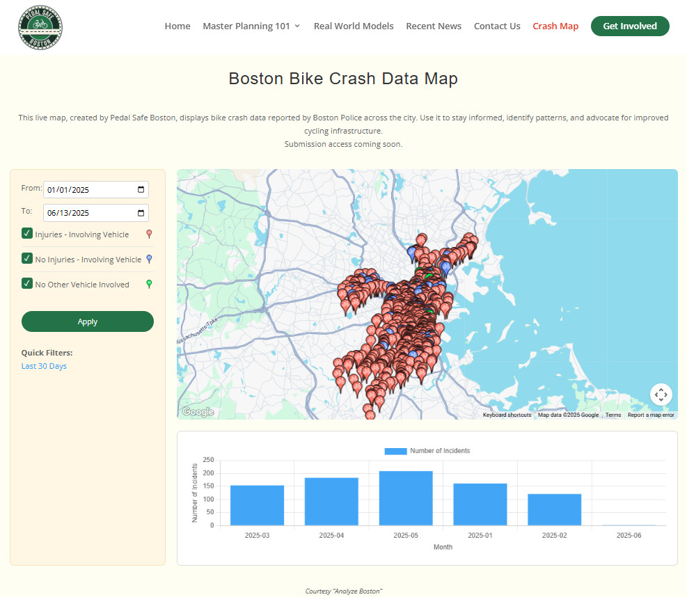
Pedal Safe Boston is launching a new tool to track where bike crashes are happening across the city. The interactive map at PedalSafeBoston.com/CrashMap uses crash data reported by the Boston Police Department and pulled directly from the city’s Analyze Boston open data portal. Our system monitors that data around the clock and reflects updates instantly as new reports become available, giving the public faster access than ever before.
The city’s Vision Zero map is the only visual tool it offers to explore crash locations, but it’s built for long-term planning and only gets updated a few times a year. That makes it impossible for residents to see where crashes are happening in real time.
Our map fills that gap with the most current crash data available. And soon, we’ll be adding a submission tool that lets riders report their own incidents, including crashes, blocked bike lanes, construction hazards, and other street-level risks. By combining official records with community input, we hope to build the clearest picture yet of what it’s like to bike in Boston.
Check out the map at PedalSafeBoston.com/CrashMap. Have ideas or feedback? Email us at info@pedalsafeboston.com.